John Murray - Handbook for Travellers
The following Murray maps can be found in the following editions:
1.
1895 A Handbook for Travellers in
Devon ... Eleventh Edition revised
London. John Murray. 1895, 1895 (1896). KB; TM.
A Handbook for Travellers in
Devon ... Eleventh Edition revised
London.
Edward Stanford. 1895 (1901)[1].
KB.
PLYMOUTH AND DARTMOUTH. (CaOS). Imprint: London. John Murray, Albemarle Street. (CeOS). Signature: J Bartholomew Edinr (EeOS). Scale (Ae). Copyright: (AeOS).
Description: Area from Berry Head to Saltash; Torcross to Paignton. Layer colouring with height table (Ec-Ee): section is taken from Bartholomew's 1895 map of South Devon.
Size: 95 x 155 mm. Scale: (3 = 40 mm) Miles.
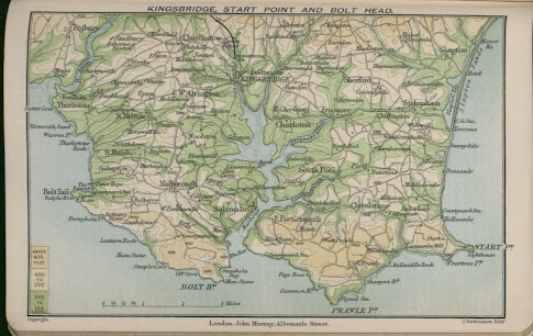
KINGSBRIDGE, START POINT, AND
BOLT HEAD. (CaOS). Imprint: London. John Murray, Albemarle Street. (CeOS). Signature: J Bartholomew Edinr (EeOS). Scale (Be).
Copyright: (AeOS).
Description: Area from Prawle Point to Goveton and Butter Cove to Start
Point. Layer colouring with height table (Ad): section is taken from Bartholomew's
1895 map of South Devon.
[1] Title page is still that of Murray but Stanford's name has repleced Murray's on the spine. See also note on p.xvii.


No comments:
Post a Comment